The amazing sight of a dolphin pod curiously circling a bobbing space pod this week topped the BBC “Most viewed” videos. Anyone who has read Douglas Adams “Hitchhiker's Guide to The Galaxy” might have pondered on whether this was a “storyline that should have been”, have you heard about an AI initiative called SPACEWHALE? Sometimes the truth can be stranger than fiction…
Satellite technology has changed our world but the diversity of its applications is only now being more fully explored. And alongside this revolution has come the rapid development of AI as a means of analysing incomprehensibly vast amounts of data at lightning speed. And now an innovative project which is a marriage of the two techs is being used to further our understanding of whale populations and densities globally.
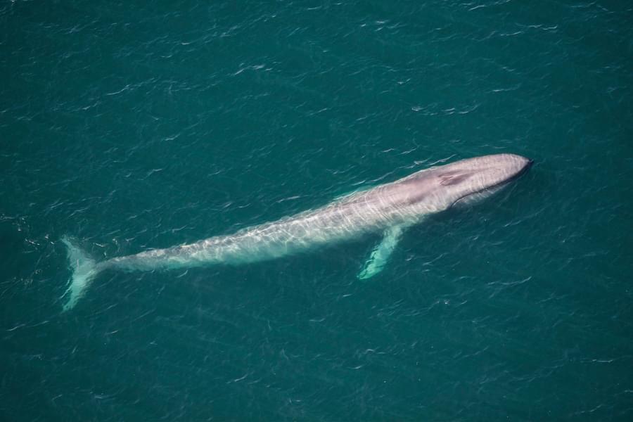
SPACEWHALE counts whales and other wildlife species from space using satellite imagery. These images are analysed and evaluated in a semi-automatic process combining state-of-the-art artificial intelligence and quality assurance by marine mammal experts.
In their own words “SPACEWHALE can answer key questions about how many whales of which species inhabit a sea area of interest and when they occur. This allows study of previously unexplored areas and can help accelerate the designation of Important Marine Mammal Areas (IMMAs) and Marine Protected Areas, provide environmental impact assessments for offshore wind farm operators, and offer an efficient tool for mandatory baseline monitoring of whale populations.”
So on the plus side, we’ve said before how much ocean-based survey analysis has lagged behind its land-based cousins owing to the inaccessibility of remote whale hotspots, and application of this tech comprehensively addresses this. The image resolution is strong enough to be able to clearly identify (larger) whale species even from space.
But you can well imagine the negatives too. It’s clear that development of this innovation will also be of considerable interest and value to a range of commercial interests, not least whaling fleets, since they could pin-point whale locations in real time. While SPACEWHALE’s development of this technology has the whale’s interests at heart, others may be interested for very different reasons.
The results also provide a snapshot at a single moment in time, which is an incredible data collection tool but lacks the context of the whale’s behaviour and interaction with its environment which (for example) ORCAs ship-based survey efforts are able to more fully record and interpret. But that’s perhaps being picky since the two approaches complement each other and create a very powerful data set.
At present, while the satellite resolution can enable identification of large species, such as blue whales and humpbacks, it can’t identify individuals and smaller cetacean species would be hard to distinguish. So SPACEWHALE is developing an algorithm which AI uses to distinguish between species. The results are already being used to inform the definition of Important Marine Mammal Areas where survey efforts are expensive and hard-to-reach, and this is just the start.
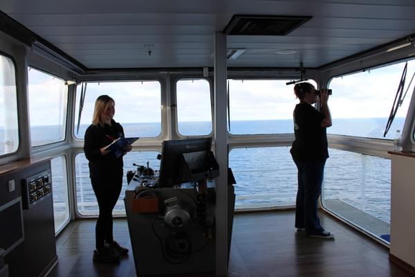
The only way we can protect whales and dolphins is by understanding their distribution, and so monitoring is vital for effective conservation. Utilising the UK ferry network, our volunteer Marine Mammal Surveyor teams board ferries leaving ports across the UK to monitor whales, dolphins and porpoises. Do you want to become a Marine Mammal Surveyor in 2025? Now is the time to sign up - our next course is on the 5th April. To find out more, visit orca.org.uk/train